The adjoining parishes of Borough Fen and Newborough share a common history dating back even beyond the original “Borough Great Fen”, the vast wetlands area common to all the parishes owned by the Abbots of Peterborough.
Bronze Age barrows indicate early settlement on the slightly higher ground to the west, and later Iron Age occupation at Peakirk Moor. During the Saxon and Medieval periods Borough Fen lay permanently underwater, a haven for wildfowl, fish and eels which provided a staple diet for its population.
Attempts to drain the fenland became a reality in the 17th century, when the Dutch engineer, Cornelius Vermuyden’s plans were set in motion. One of the earliest dykes cut was the Highland Drain, which runs parallel to the Thorney Road and forms part of the boundary between the two parishes. An Act of Parliament in 1812 forced the sale of land in Borough Fen to pay for drainage, and at the same time, allocated parcels of land in the parish to its common tenants. Further land sales were made under the Enclosure Act of 1822, with some of the proceeds funding the modern parish of Newborough in the southern part of Borough Great Fen.
The rural parishes of Newborough and Borough Fen are mostly farmland. Up to around 1900 the land was mainly pasture, with grazing for sheep and cattle, and pink feet and grayland geese were a common sight right up to the beginning of World War II. More efficient drainage systems have led the way to mixed and arable farming and today the main crops are cereals and sugar beet. However, with the decline of sugar refining in the area, Oil seed rape and more recently Linseed have taken over.
The Borough Fen Duck Decoy is one of the oldest still in use in Britain. The earliest known reference to the decoy dates from 1670 when a Mr Williams, acting for the Earl of Lincoln, was granted permission to take water by ditch from the nearby River Welland for the pond. The decoy remained in the hands of the Williams family until the death of Billy Williams in 1958.
The Decoy
The Decoy consists of eight “pipes”, or covered ditches, radiating out from a central pond. Wildfowl landing on the pond are enticed through the pipes and caught in a netted area at the far end.
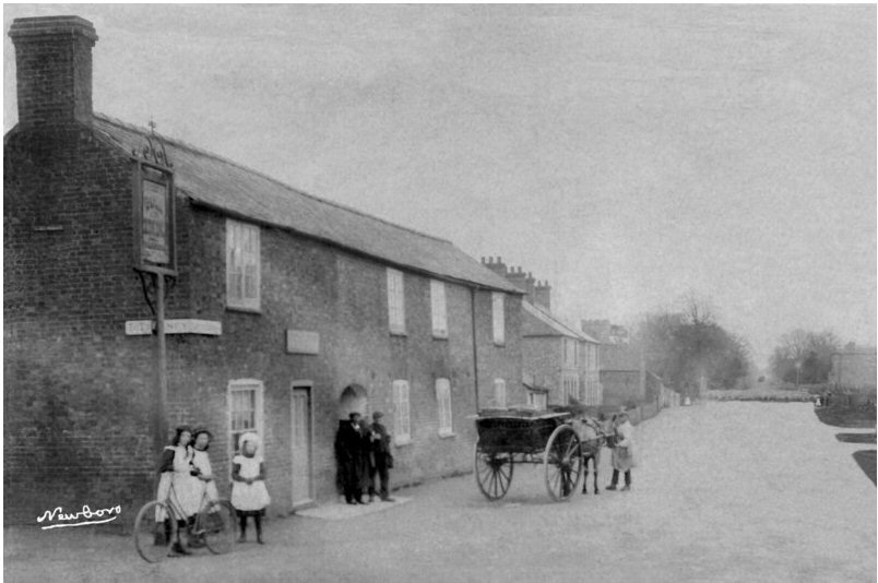
The Bull Inn. Circa 1900.
The ringwork on Peakirk Moor, now bisected by Decoy Road, dates from the middle Iron Age. The remains of an irregular circular ditch with an internal rampart can still be seen quite clearly in the northern part of the site. The settlement resembles a low-level Iron Age hill fort and may be one of a series of forts built along the boundaries of the Catuvellauni and Coritani tribes.
Car Dyke is thought to have been built by the Romans, perhaps to carry masonry stone from Peterborough to Lincoln. In this area the dyke became an integral part of the fenland drainage system.
The hamlet of Milking Nook lies a mile or so to the west of Newborough. It was so named because in the 18th and 19th centuries, farmers from neighbouring villages brought their cattle here for summer pasture. The cows were herded from Barnack, Northborough, Glinton and Bainton along their own “droves”; the names of the droves have survived, although the new roads do not match the ancient routeways.
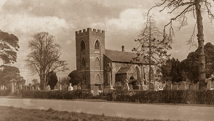
St Bartholomew Church Circa 1900
Newborough Church was built in neo-Gothic style in 1830 and dedicated to St Bartholomew, a saint also associated with Crowland Abbey. The church was financed by the sale of part of the Borough Fen estate at the time of the Enclosures in 1822.As the church was built on Crown Land, a Royal coat of arms is displayed inside the church.
In the early 1900s, Crowtree Farm was owned by Frederick Griffin who made his name by breeding shire horses for export to Europe and, especially, America. Frederick Griffin was a church warden at Newborough, where there is a stained glass window to his memory. Crowtree Farm is now a mixed farm, owned by Frederick Griffin’s great-great grandson.
Fletchers Farm dates from the early 19th century. It was sometimes known as Browne’s Hospital Farm because it provided fresh produce for Browne’s Hospital in Stamford.
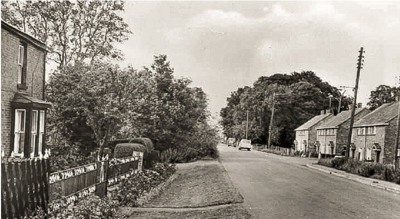
Guntons Road. 1960s.
Hill Farm is possibly associated with John de la Hille, thought to be one of the knights who left from Peterborough Abbey to join the Crusades. Certainly, in the 15th century, John de la Hille received a parcel of land in this area as reward for services to the Crown, which became known as Palmer’s Hill. The existing farm buildings were originally shepherd’s cottages built in 1834.
St Kennulph’s Stone, or Kenulph’s Cross, is thought to be one of six ancient stones which marked the boundaries between the lands owned by Peterborough and Crowland Abbeys. It takes its name from Kenulph, who became the first Abbot of Crowland in 716.
The earliest known occupant of Eardley Grange was Sampson Gideon (1699-1762), son of a Jewish Portuguese immigrant. Sampson Gideon was an immensely shrewd financier who, having made his own fortune, spent the last twenty years of his life raising loans for the British government, often to the detriment of his own finances. An amiable and generous man, Sampson Gideon left substantial sums of money to charities both Jewish and Christian. This tradition was maintained by his descendants and an educational trust fund set up by a member of the Eardley family and still exists in Newborough today.


